top of page
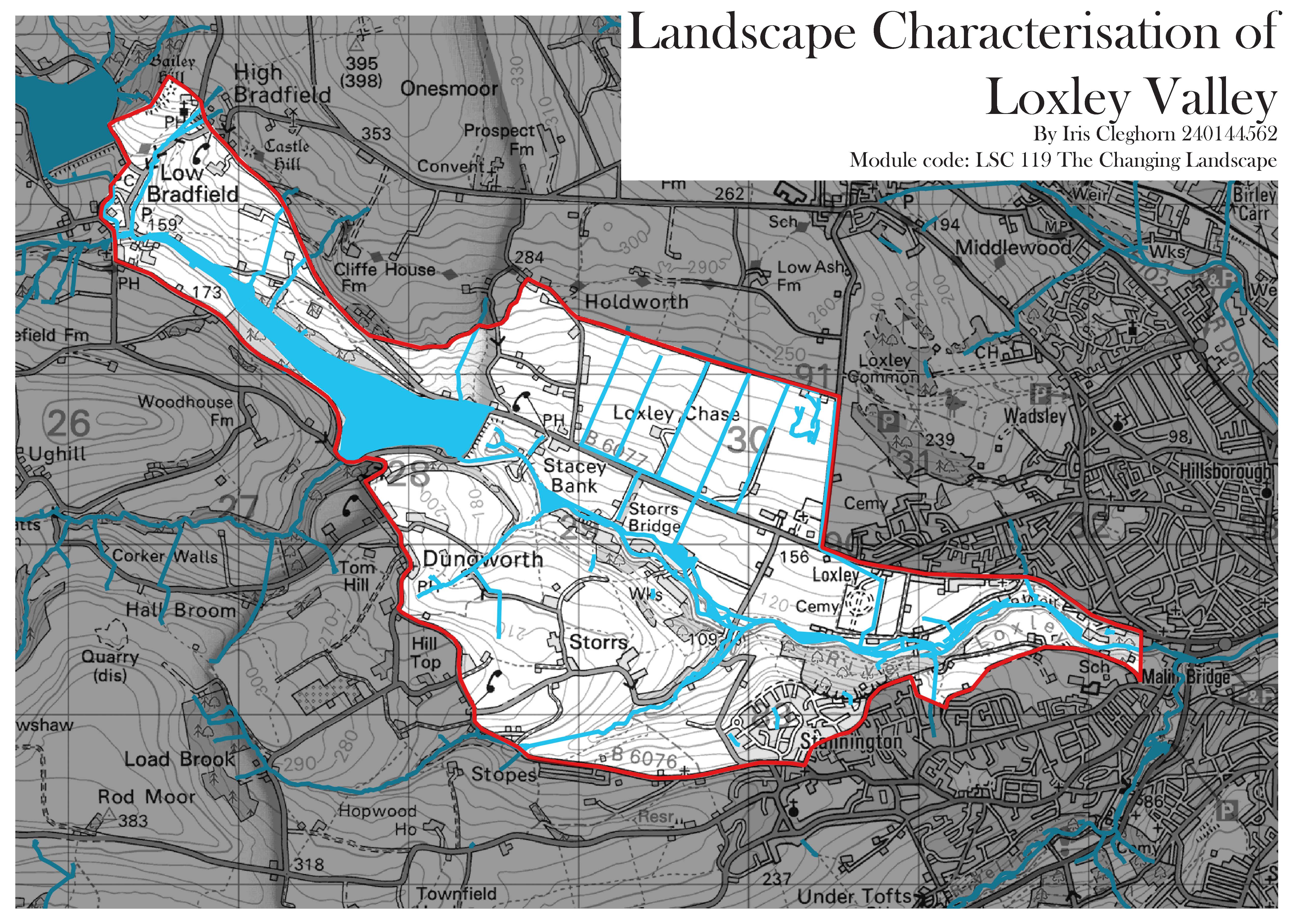
Landscape Characterisation of Loxley Valley
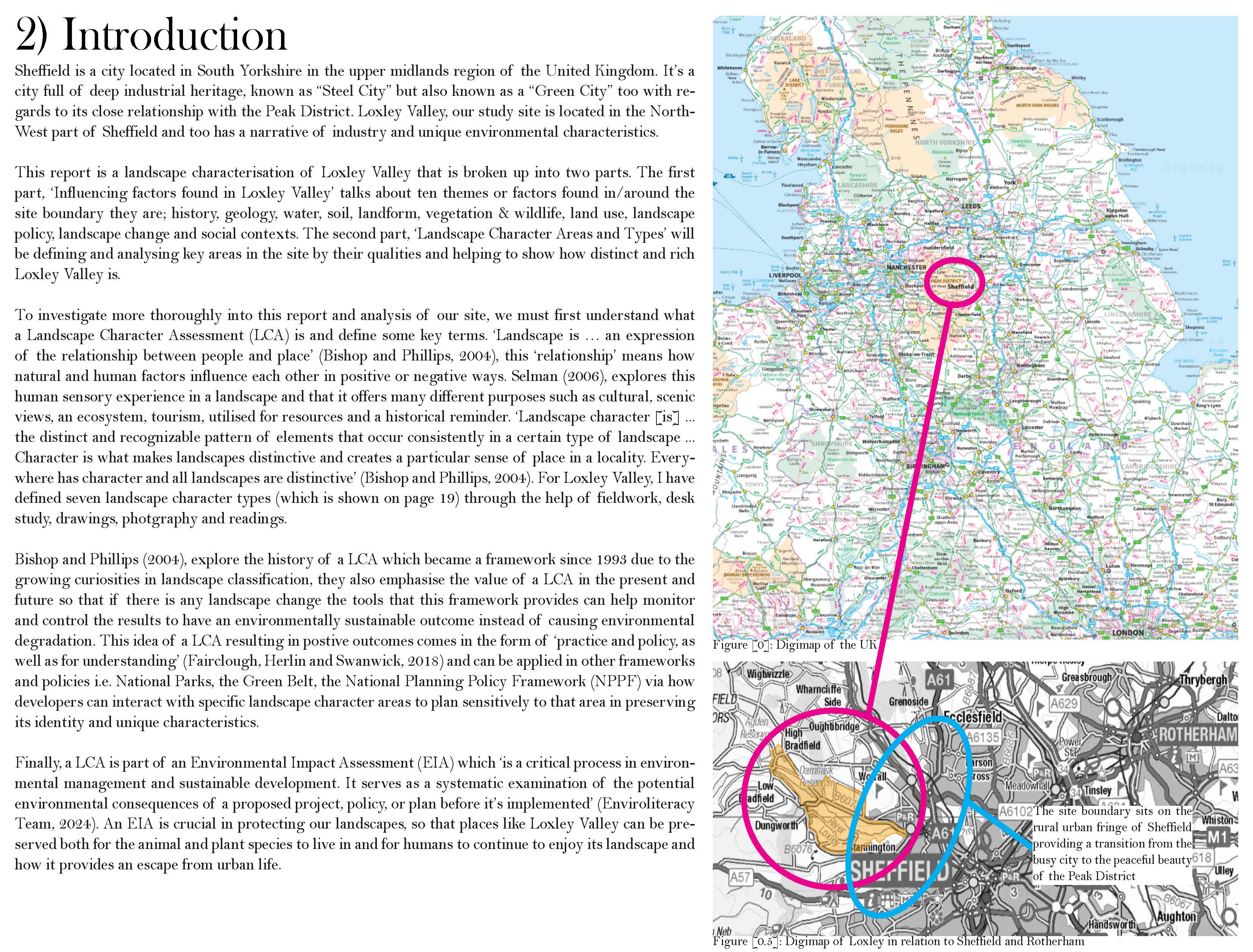
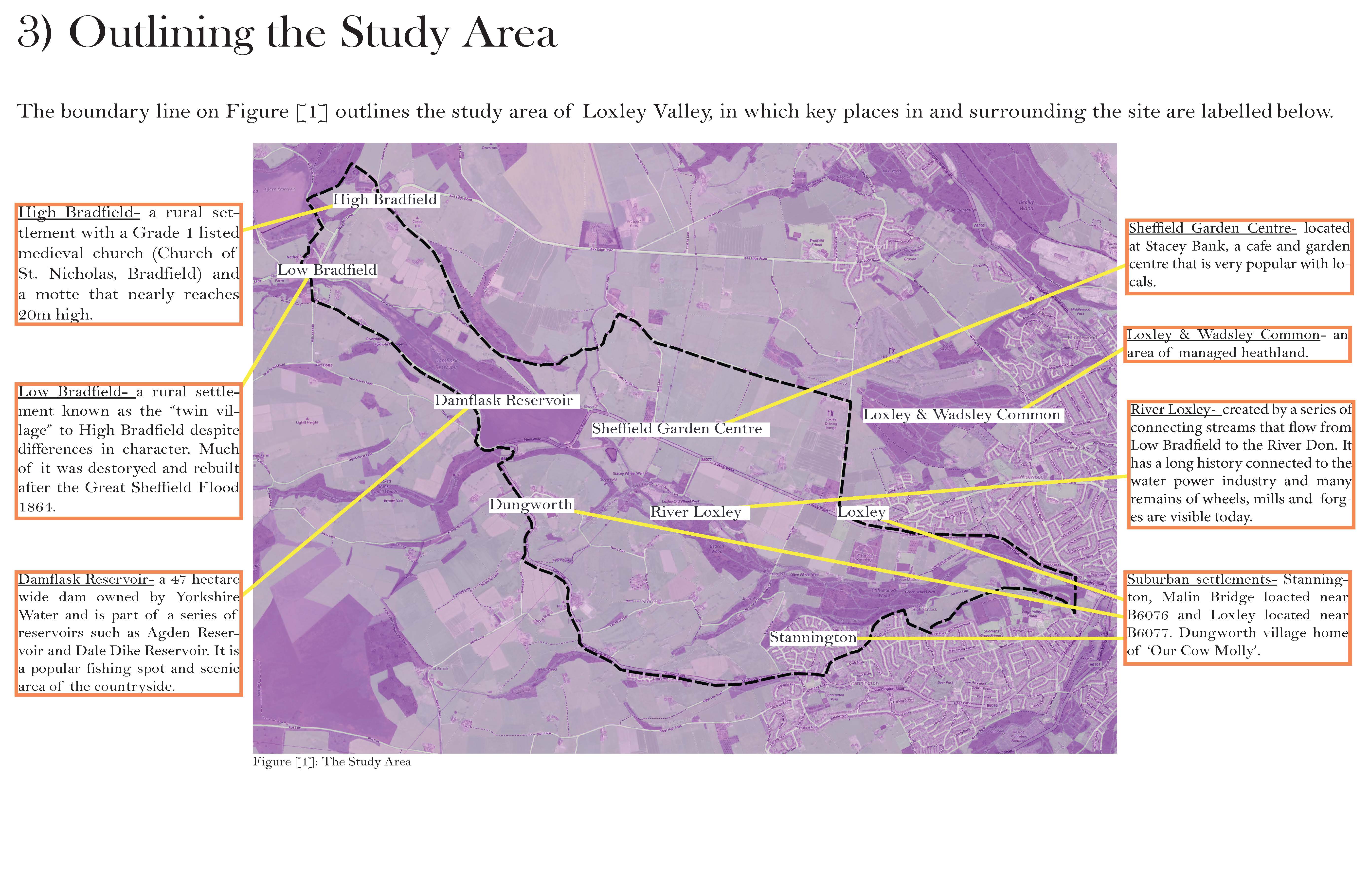
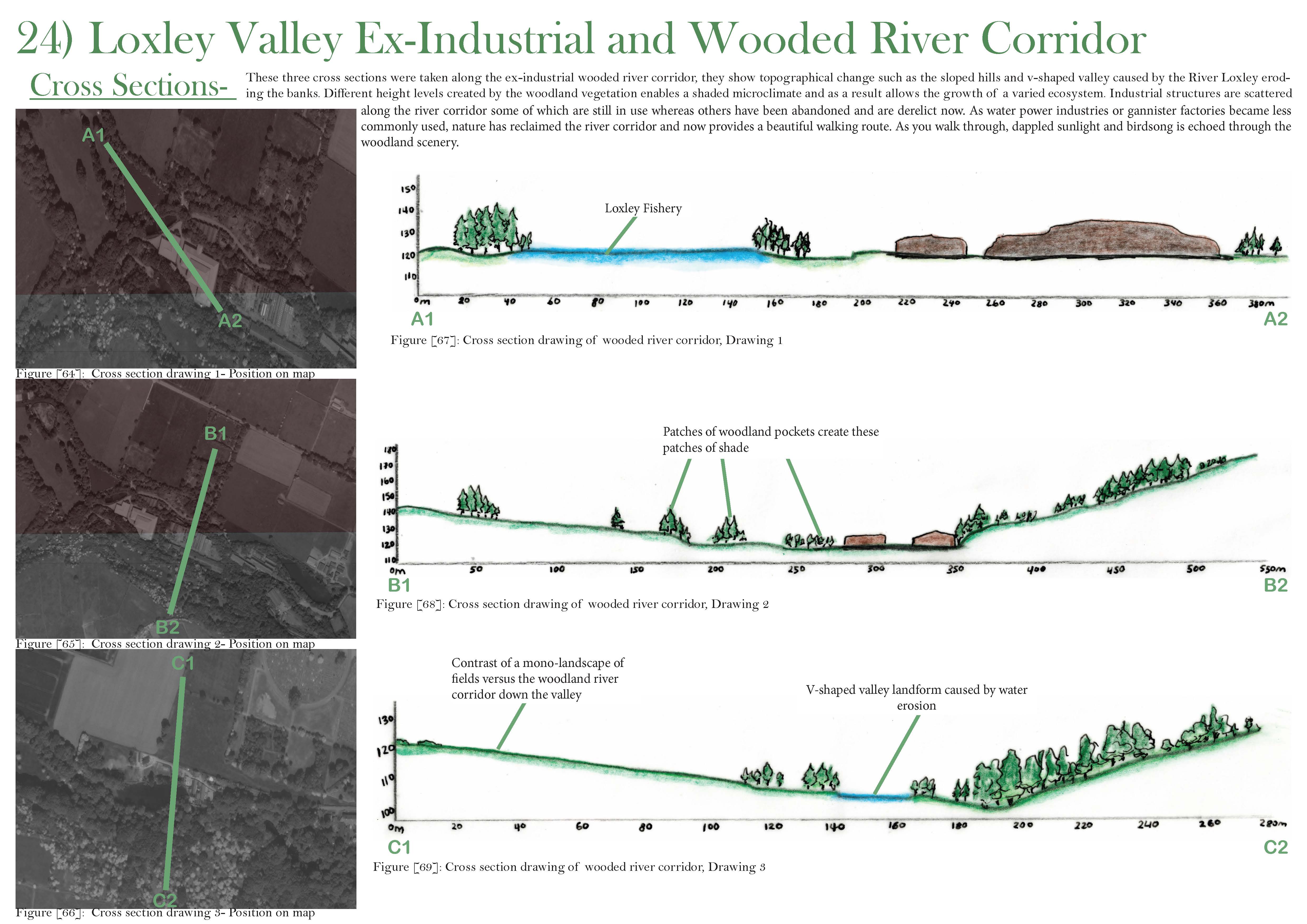
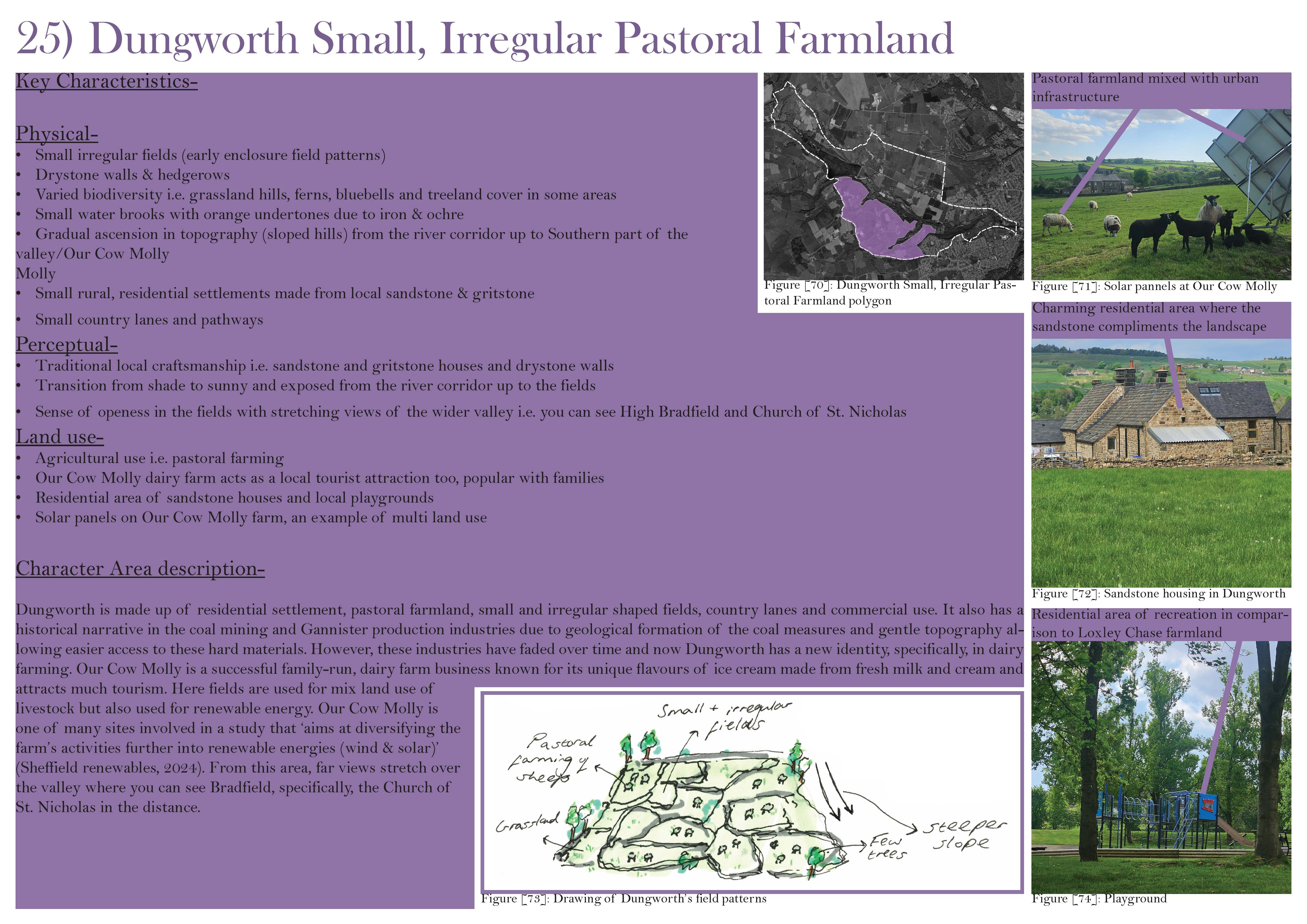
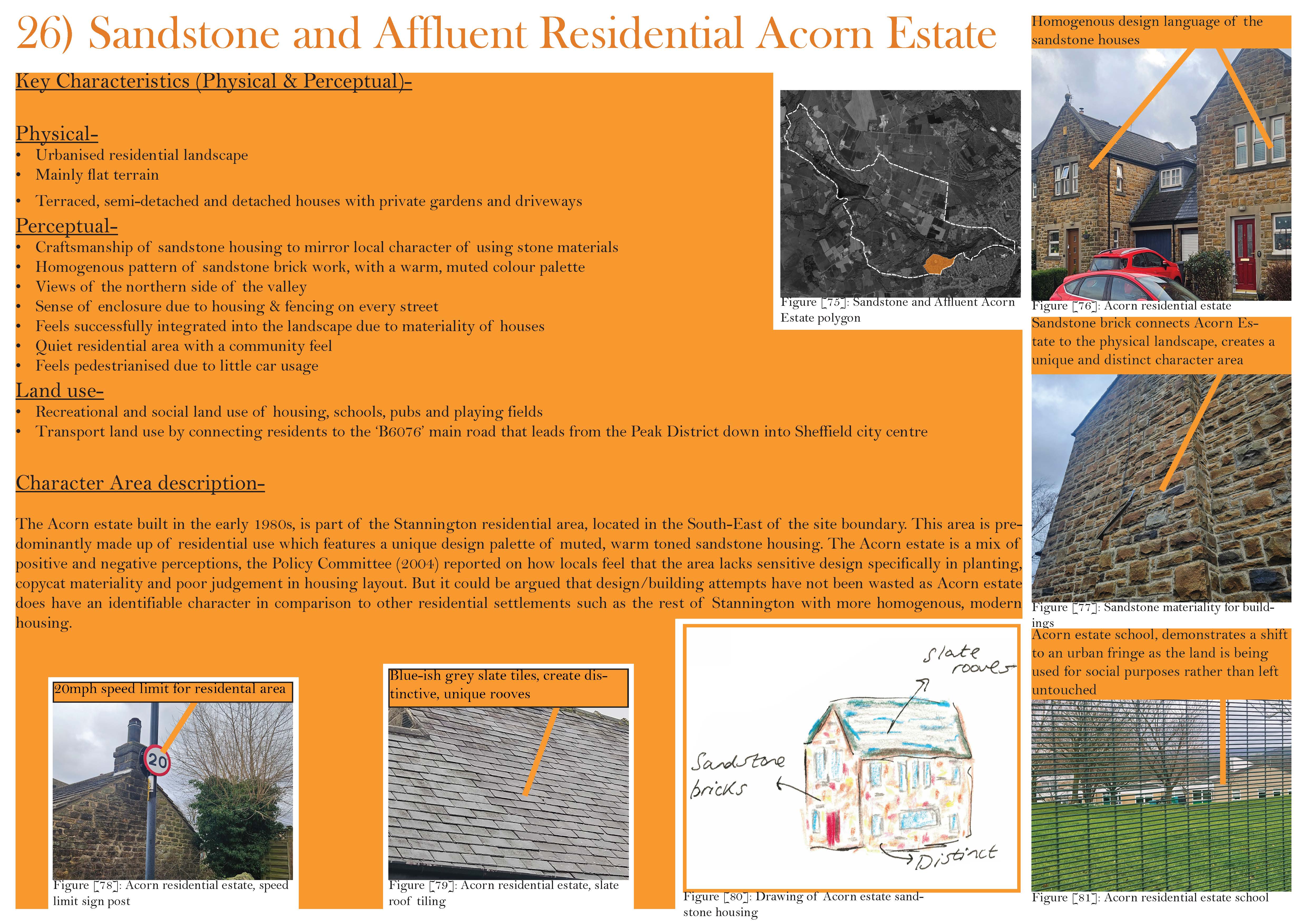
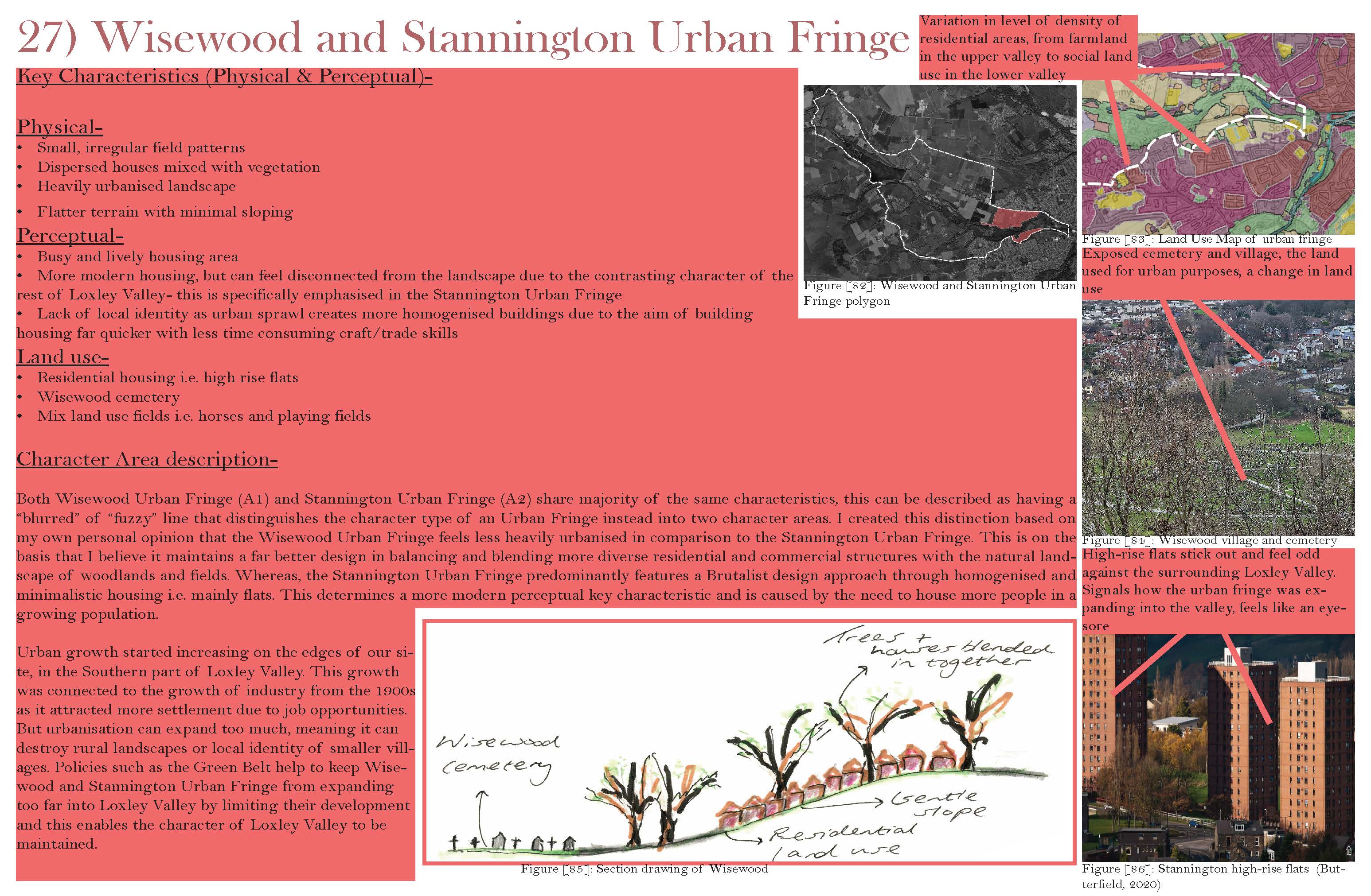
A landscape analysis examining the environmental, historical, social, and policy factors that shape the Loxley Valley. The project combined desk-based research, GIS mapping, fieldwork, photography, and observational drawing to assess ten key landscape layers, including geology, hydrology, ecology, land use, and landscape history. Building on this research, the project identified and defined distinct Landscape Character Types and Character Areas, culminating in a detailed character assessment of the Loxley Valley through annotated drawings, photographs, sections, and spatial analysis to explore its physical, ecological, and sensory qualities.
Project type
Landscape Characterisation Assessment
Date
5th June 2025

01
Landscape Characterisation of Loxley Valley

01
Loxley_Portfolio-_Iris_Cleghorn_Page_01

02

03

04

05

06

07

08

09

10

11

12

13

14
Loxley_Portfolio-_Iris_Cleghorn_Page_14

15

16

17

18

19

20

21

22

23

24

25

26

27

28

29
Loxley_Portfolio-_Iris_Cleghorn_Page_29

30

31

32

33

34
- Loxley_Portfolio-_Iris_Cleghorn_Page_01
- Landscape Characterisation of Loxley Valley
- Landscape Characterisation of Loxley Valley
- Landscape Characterisation of Loxley Valley
- Landscape Characterisation of Loxley Valley
- Landscape Characterisation of Loxley Valley
- Landscape Characterisation of Loxley Valley
- Landscape Characterisation of Loxley Valley
- Landscape Characterisation of Loxley Valley
- Landscape Characterisation of Loxley Valley
- Landscape Characterisation of Loxley Valley
- Landscape Characterisation of Loxley Valley
- Landscape Characterisation of Loxley Valley
- Loxley_Portfolio-_Iris_Cleghorn_Page_14
- Landscape Characterisation of Loxley Valley
- Landscape Characterisation of Loxley Valley
- Landscape Characterisation of Loxley Valley
- Landscape Characterisation of Loxley Valley
- Landscape Characterisation of Loxley Valley
- Landscape Characterisation of Loxley Valley
- Landscape Characterisation of Loxley Valley
- Landscape Characterisation of Loxley Valley
- Landscape Characterisation of Loxley Valley
- Landscape Characterisation of Loxley Valley
- Landscape Characterisation of Loxley Valley
- Landscape Characterisation of Loxley Valley
- Landscape Characterisation of Loxley Valley
- Landscape Characterisation of Loxley Valley
- Loxley_Portfolio-_Iris_Cleghorn_Page_29
- Landscape Characterisation of Loxley Valley
- Landscape Characterisation of Loxley Valley
- Landscape Characterisation of Loxley Valley
- Landscape Characterisation of Loxley Valley
- Landscape Characterisation of Loxley Valley
bottom of page